AS 26 May 2026
Mynydd Troed
Tue, 26 May 2026
7:00 PM
Details updated
Distance
5km / 3.1mi Climb
320m / 1050ft Safety information
AS Navigational skills required
Minimum age
Over 12
Juniors
Sorry no Junior races
Extra details
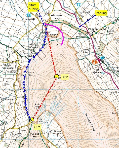
Car Park and race HQ - Pengenffordd W3W: position.moving.acquaint Grid ref: SO171301
Route – Start/Finish as on the map. The route is basically unmarked. (But see below)
The route follows the wall/fence field boundary southwards, on an obvious rough track/path, all the way around the west flank of Mynydd Troed to CP 1, near the gate to the lane. From here, you turn north and climb any line to the summit Trig. From the Trig, you can take any line back to the Finish. ONLY the lower part of the ridge descent is marked, (purple on the map) to the Finish. You DO NOT have to follow it.
Location
Pengenffordd, S.Wales SO171301
Enter
Entry on the night only (Max 90) £5 CASH ONLY
Organiser
Andy Creber
01291 625487, 07530 442066
ac@ghost.org.ukInsured by WFRA